Showing posts with label Places to Swim. Show all posts

Thursday, August 1, 2019

The Waterfalls & Swimming Holes Of Rock Run

Rock Run is a gorgeous area, full of deep swimming holes, with crystal clear, cold, water.
There are potholes, chutes, slides, and even three waterfalls.

This is a VERY rural area - with little to no cell phone service, and no stores or gas stations nearby.  

The solid rock channel here is worn smooth from the water flowing through.

Located above Ralston PA, about 40 Minutes north of Williamsport.
Your best bet for directions is to type Rock Run, Pa into google maps.

In many areas, the water is quite deep.  And very cold.

There are large parking areas across from both the Upper and Middle Falls.  It can be easy to miss the signs for the falls trails, but just look for the large parking areas on your left, the signs for the trails will then be on your right.


From there, a short steep walk downhill takes you almost right to the falls - they are pretty easy to get to, and hard to miss.
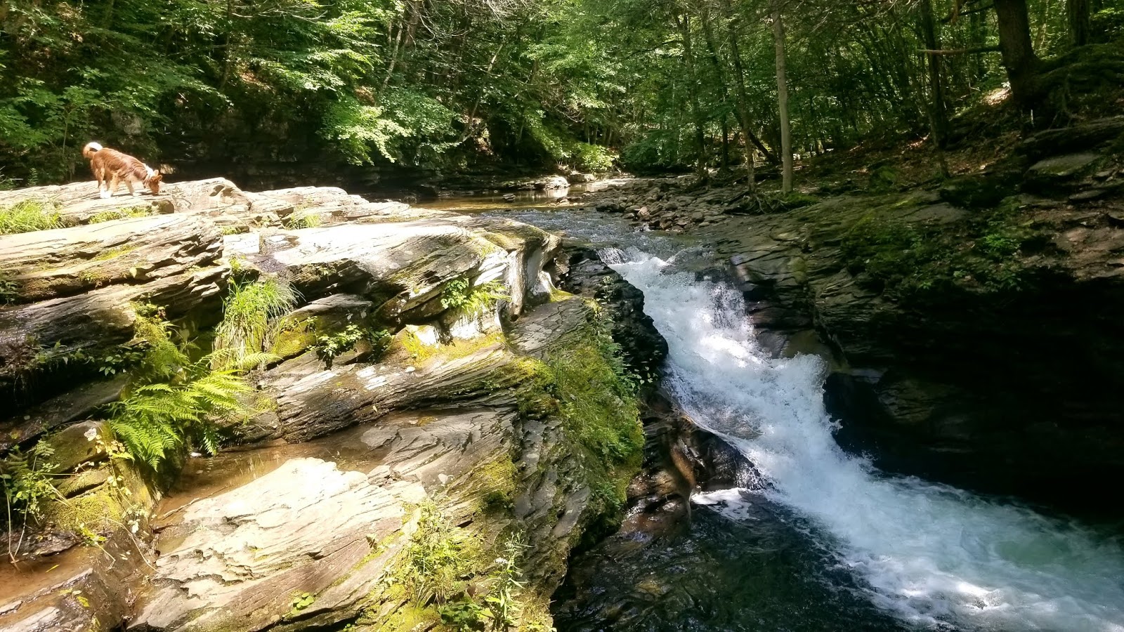

Upper Falls At Rock Run
41°31'20.1"N 76°54'22.9"W

Another view of the upper falls & the beautiful water here.

Middle Falls At Rock Run
41°31'02.0"N 76°54'46.3"W

Middle falls also has it's own large parking area, almost identical to upper falls.  Park, Cross the road, walk down.  

Another view of Middle Falls

This was the only spot all day where we ran into other people, although there were cars driving in and out all day - obviously lots of people were here, we just managed to be in different areas at all times.  There are a LOT of places to swim here, so it's possible, at least on a week day, to avoid other people by choosing another area to swim!  The two guys here were fishing, trying to catch a palomino trout that we could see hanging out under a ledge near here.
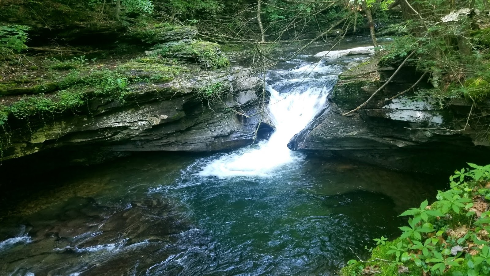
The Lower Falls At Rock Run
41°30'48.2"N 76°55'13.4"W

Lower Falls Also has a parking area and a trail. But from that trail, we did not see the falls! We found what I am pretty sure are the lower falls almost by accident.  Instead of parking in the large parking area, we parked in a small pull off on the right.  There as a white sign stating that the area is for day use only.  We walked down, crossed the creek (got our feet wet - no avoiding that - but we were swimming so it didn't matter) and then followed a well worn path down the creek.  The falls were just a short distance down the path.

There are so many great areas to see here - it's a beautiful place!


 =======================


Friday, July 19, 2019

Six Natural Swimming Holes - Places Cool Off In This Summer

Places To Swim

Earlier this week I watched a group of Mennonite men walk up to the Watsontown Park from the river, where they had been swimming.  Although swimming is forbidden at many  boat launch areas (where fishing is allowed), it is permitted in all of the rivers and many of the creeks in PA.   Of course, use common sense, and be safe!  Many of our rivers and creeks can be very dangerous at times. 

 Here are a few of the best spots to cool of this summer.
===============
Lakes
================

 The Lakes At Half Way Dam, Rickets Glen, Poe Paddy,  Bald Eagle, or Hills Creek  State Parks.   Many of our state parks have beaches, with seasonal concessions.  

Bald Eagle State Park
149 Main Park Rd, Howard, PA 16841
Located about 45 minutes west of Williamsport

Poe Paddy State Park
1087 Poe Paddy Dr, Woodward, PA 16882
About an hour west of Mifflinburg - like Half Way Dam, the water here is always cold.  Although maybe not AS cold as Half Way Dam!

Raymond B Winter State Park (Half Way Dam)
17215 Buffalo Rd, Mifflinburg, PA 17844
Located miles 17 miles west of Lewisburg, in rural Mifflinburg Pa.
https://susquehannavalley.blogspot.com/2012/07/at-half-way-dam-today.html

Ricketts Glen
695 State Route 487, Benton, PA 17814
About 40 minutes east of Muncy

=============
Rock Run
==============
Follow Us 15 North And PA 14 N to Thompson st in Ralston Pa.
Turn Right onto Thompson st, follow it to Rock Run Road.

In Google Maps, Type "Rock Run Swimming, Trout Run, PA 17771" for navigation

Backpacker magazine named Rock Run one of the best watering holes in the United States.  There are several natural pools here, some with crystal clear water.  

=============
Kocher Park
==============

1519 State Route 487, Orangeville, PA 17859
Less than 10 minutes from Bloomsburg Pa
Kocher park is a free park, open to the public, offering access to a nice deep  swimming hole in Fishing Creek.

=============
The Haystacks
==============
Near Laporte Pa, Part of the Loyalsock Creek
This one is a bit of a drive, and a bit of a hike - but it is an incredible place to play in the water.  And you can see a waterfall near the start of your hike too!

=============
Picture Rocks 
==============

Take 220 into Picture Rocks.  Cross a small bridge, and turn right on water street.  The Rocks will be about 3 blocks back on the right.  There's pull off parking along the road on the right.  

=============
CREEKS
==============
We are blessed with a multitude of creeks, and all of them have swimming holes, and many rope swings, along them!  It might take some exploring to find them..  but here are a few places to start looking -   (As always, use common sense, caution, and be respectful of private property near the creek borders -it is not ok to walk through private property, without permission,  to access public water)

Black Hole Creek
Running through Montgomery Pa.  There's a nice swimming hole behind the area of the Weis Markets (I'm not sure how to access it) and you can access the creek from Heritage Park behind the Montgomery Library.

Loyalsock Creek
There's a "beach" of rocks right beside the green bridge in Montoursville.  The bike trail leads down under the bridge, making easy access to this area.    Follow the road to the south, along the creek, and there are other spots that are absolutely beautiful along this section.

Further north, near the Pier 87 restaurant, and near the game farm are also popular swimming spots.

Muncy Creek
A few years back, we put our kayaks in behind Halls Landing in Muncy, and Kayaked down to the river.  Along the way were several great spots to swim, one area in particular had a rope swing.  It wasn't too far down from Hulls Landing, but I cannot remember the exact location of the rope.

Penns Creek
There are literally dozens of great spots to swim along penns creek.  Some of the most popular seem to be near the covered bridges, and the red metal bridge, near New Berlin Pa.  N 40° 52.392 W 077° 03.978 will take you to a small picnic area with parking, that is a popular spot to put kayaks into the creek, and swim, as well.  

Twin Run
There's a swimming hole near the YMCA, in Twin Run Creek, In Muncy PA.  I'm told it's a little steep to access it, but a nice place to swim.

White Deer Hole Creek
In Allenwood Pa, take the little road to the right of Weavers Parking lot, and follow it to the green bridge.  We've taken the kayaks out there, it's a bit steep for kayak access, but it's pretty easy to climb down to the creek.  Whether there is enough water there to swim or not, is a different matter.


===============
READ MORE
================
All of the PA State Park Swimming Areas
https://www.dcnr.pa.gov/Recreation/WhatToDo/Swimming/Pages/Where-to-Swim.aspx

Although often listed as one of the top swimming holes in PA, swimming is unfortunately not permitted at Devils Pool in Wissahickon
https://www.inquirer.com/philly/health/environment/no-you-cant-swim-in-devils-pool-at-the-wissahickon-really-20180531.html

Not a natural swim area, but if you have small children, be sure to check out the Splash Park  in Sunbury Pa
https://www.facebook.com/oppenheimerplayground/?rf=531221610388543

If traveling in the western part of the state, the Meadow Run Natural Water Slide at Ohiopyle State Park is so much fun!  The rock forms an all natural water slide!

What Rights Do The People Have In Public Waters?  And Which Waters Are Public Waters?
The rights of the public in public waters are quite broad and extend to fishing, boating, wading, floating, swimming and otherwise recreating.  As to which are definined as public waters, there is no complete list, but this site may help:
https://www.fishandboat.com/LearningCenter/FAQs/Pages/PublicAccess.aspx

Another interesting article - 
https://www.outdoornews.com/2017/06/29/understanding-pennsylvanias-stream-trespass-laws-important-part-1/


=========================

================

Monday, April 8, 2019

"The Rocks" at Picture Rocks PA

Directions - Take 220 into Picture Rocks.  Cross a small bridge, and turn right on water street.  The Rocks will be about 3 blocks back on the right.  There's pull off parking along the road on the right.

Sunday, July 29, 2012

The Haystacks


The Haystack Rapids are a series of rock formations that look like "haystacks", in the Loyalsock Creek.  They are a really neat sight to see, and also a great place to swim.
Located  off the Loyalsock Trail, near Laporte in Sullivan County PA.  From Hughesville, it's about a 40 minute drive.  Take 220 N, and turn left on Mead Rd, which will be just a bit past the turn for downtown Laporte.  Dutchman Falls are near the parking area, as well.  

Mead road leads right into the Loyalsock Trail parking area.    From there you will find the trail to the haystacks well marked.  It's about 2.5 miles from the parking area to the Haystacks.  


From the LT parking area (which is nice, with a picnic table, and non flush bathroom) you can walk straight down and to the left to Dutchman falls. It's a short hike down, but a steep climb back up.

pretty rock tunnel near Dutchman Falls

 Above Dutchman falls - the first part of the waterfall
Dutchman Falls

Half way from the parking lot to the falls, you cross this railway bed. This is the easy hike to the Haystacks - it's about 2.25 miles, with 2 of them on a flat easy surface, shown above.

 This was on a Sunday afternoon - it wasn't crowded, but there were other groups of people here.
There are lots of flat rocks around here too, perfect for napping, and picnics.

This is at the start of one of the rock "slides".  The water carries you right through here, and over a very small waterfall at the end.


Looking downstream

Looking upstream

This is the end of the hike to the haystacks - it's still pretty level, and easy.  The only difficult part at all is the climb back up to the parking lot at the end.  


=================================
Places To Hike

Wednesday, July 25, 2012

At Half Way Dam Today


We have a fresh air kid staying with us this week, so a trip to Half Way Dam was inevitable.  It's actually R.B. Winter State park now, but my gram grew up coming here to "Half Way Dam", and that's  what almost all the locals still call it.  

For directions, go here:
 
This is a free, public access, beach, so even on a week day, it's crowded by afternoon.  

It does not matter how hot it is, or how long the temps have been high,this water is ice cold.  Always.  Often families will bring a watermelon and put it in the creek across from the lake, to chill it.

 The cold water never bothers the kids for long..  and I admit that I didn't have any trouble swimming here today either.

 This is also one of the few sand beaches in the area.

The kids caught a salamander  -

It's a gorgeous area, with local trails and fishing areas, and camping, and an educational center..It's a great place to spend a day.