
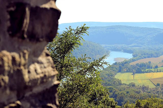
Wysox Overlook

Wysox Pa
Follow 220, then turn onto Red Rock Road
GPS coords - N 41° 46.379 W 076° 22.198
The geocache here is named "Inspiration Point" GC11EPH
See larger versions of the photos here - https://www.facebook.com/media/set/?set=a.433069853562101.1073742025.175207949348294&type=3

Wyalusing Rocks:


Wyalusing Pa
GPS Coords - N 41° 41.544 W 076° 16.368
The Geocache here is named "Enjoy The View" GC3FCVK
Located 500 ft. above the Susquehanna River, this site was used by the Iroquois Indians as a signaling point
Marie Antoinette Overlook:

Wyalusing Pa
GPS Coords - N 41° 43.879 W 076° 17.852
The Geocache here is named "Queens River Viesta" GC1D61D
More about French Azilum & The Overlook - http://susquehannavalley.blogspot.com/2015/09/french-azilum-marie-antoinette-overlook.html
"Legend has it that the colony was to be the new safe haven for Queen Marie Antoinette, refuge from “The Terror” of the French Revolution. But she “danced with Mdm. Guillotine” very early on in the colony’s history, so it’s unlikely. But it makes for a great story!
You can see the French Azilum historic site just to the left of the bend in the river as looking upstream. The tall white house just past the red barn is Laporte House. It was built in 1836 by the son of one of the original refugees. You can probably also make out the picnic pavilion and the late 1700’s era log cabin used to tell the history."

No comments:
Post a Comment
I'll read the comments and approve them to post as soon as I can! Thanks for stopping by!