Showing posts with label Outside Of The Valley. Show all posts

Monday, April 22, 2019

The Thousand Steps Trail

The Thousand Steps Trail
William Penn Hwy, Mapleton, PA 17052


Two hours to the southwest of us is the Thousand Steps Trail.  A hiking trail of 1,000 stone steps straight up the side of a mountain.  It's a serious climb, but years ago, this was merely the miners commute to work.


The Harbison Walker Corporation began mining for sand on Jacks Mountain around 1900.  The sand was used for silica, heat resistant, bricks.  Workers were originally required to walk up the mountain each day to work, but the trail zig zagged and made the commute much longer than necessary.

In 1936, workers build a stone staircase straight up the mountain, using just over 1000 stones to climb 1,00 feet.

This is a tough climb for many of us today, but there are spots to rest along the way, and it is a really beautiful hike.  This is definitely one of my top 10 favorite hikes of all time.  Partially that may be from the sense of accomplishment in completing it, but the incredible views and variety of things to see also play a large part in my love of this trail.

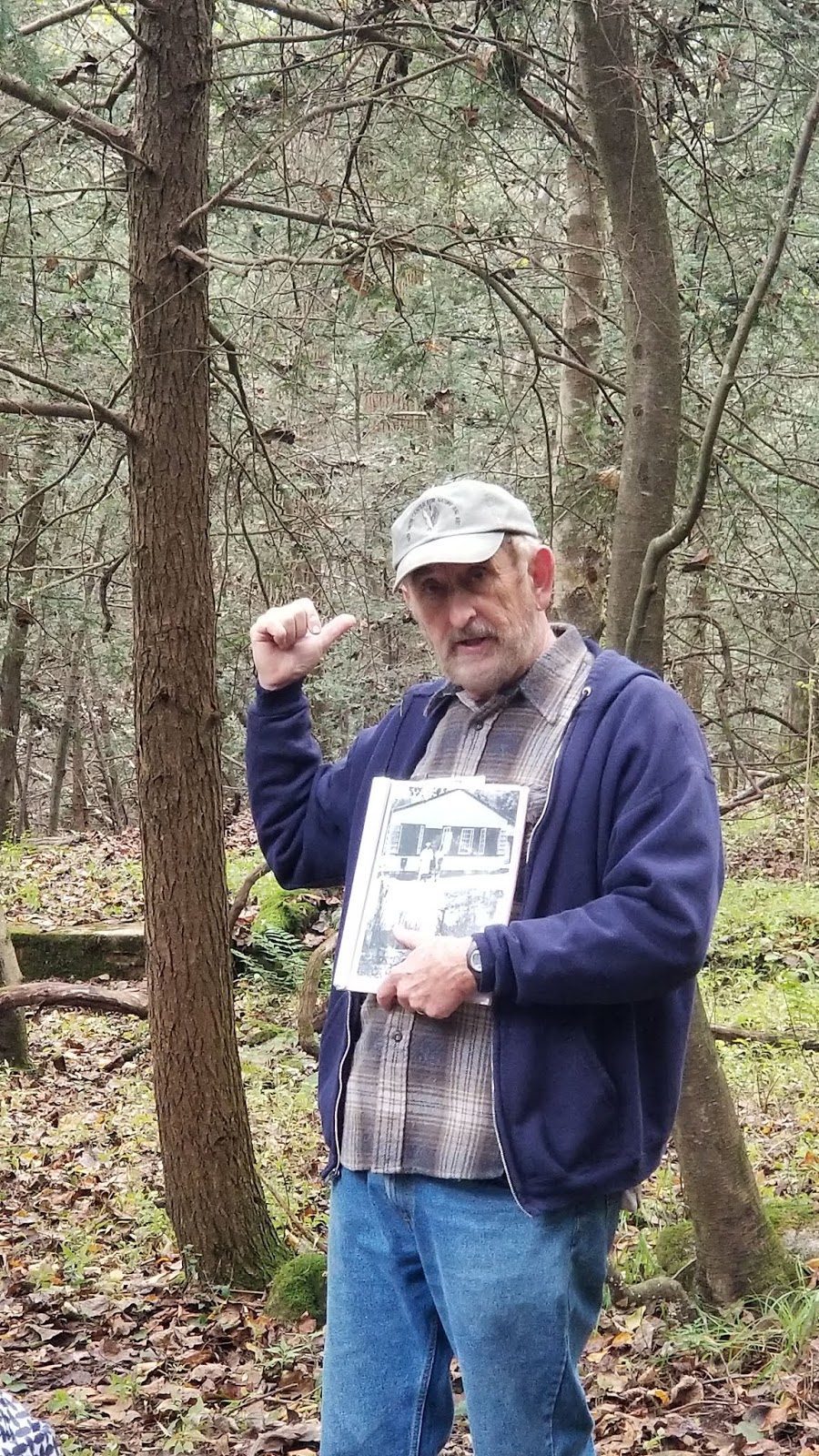
The trailhead is at large parking lot on the right hand side of highway 22 about 3/4 mile outside of Mount Union.  GPS Coords - 40.41680°N  77.8994°W.  In this photo, I'm standing near the start of the trail, looking back towards the parking area.

We were here on Easter Sunday, making the drive after sunrise service at church and arriving around 12:30 in the afternoon.  A group of teenagers arrived  at the same time, and they got started right away.  I changed my shoes, we got the dogs in harnesses, Dan looked for the nearby geocaches...  so we did start a little bit after the teens, but still, we laughed when they passed us coming back down, when we were barely half way up. The boys were running the steps.

Although not crowded, there were quite a few people on the steps that day.  We stopped often for families to pet our two dogs, and to "wait for that group to get down" before we headed up the next section.  That wait was a great time to catch our breath!  


We talked with a lot of different people that day.  An older gentleman hiking for the first time, a young family struggling to keep up with their young son who was climbing with ease.  A family who does the trail every Easter as a tradition, and a young athletic looking crew who weren't sure they were going to make it to the top. We passed an Amish couple who were not even slightly out of breath, and a  couple of teenagers who were having severe second thoughts less than 200 steps in.  

Woohoo!  The 1,000th step!

Middle aged, overweight, and out of shape - we took well over an hour to reach the top.  A lot of that truly was waiting for groups to come down a section before we headed up, on a day with less people, I think we could have made it in less than an hour.  (I know that many in much better physical shape than us, can complete this  easily in 30 minutes.)

Wait - why are there more steps???  Although this is called the 1,000 Steps Trail, there are somewhere around 1,040 steps.  I didn't count for myself, and I have found articles stating there are anywhere from 1,032 to 1,046...  It's definitely more than 1,000 and less than 1100.

At the top of the steps turn right and go less than 1/4 of a mile (much less) to this beautiful view.

While there were a lot of people on the steps, we saw almost no one on the trails to the overlooks.  To climb all those steps and not see the overlooks...  how sad.  However, I know we could have seen a lot more than we did too - there's just so much to see up here.

Along the path to the Dinkey Shed.

The "Dinky Shed" is a stone structure that serviced the Dinky trains.  It's located less than a 1/4 of a mile to the left of the top of the 1,000 steps.  

Inside the Dinky Shed.

To the right of the dinky shed are more steps. More.  Steps.  Not too many, but enough.  Climb up them, and follow the trail to the left.  It's worth it, I promise.

Once up the steps past the dinky shed, there's a beautiful, flat, less than a 1/4 mile trail to the overlook.  You will walk right along the edge of the mountain.  We saw hawks and turkey vultures flying beside us, or slightly below where we could look at their backs as they flew.
Photos really do not do this view justice at all. .  You can watch trains wind along the river and see the church in the town below.  There's a large rock here, perfect to sit on and admire the view.  
Molly and Max, helping Dan check out the geocache container they found nearby.

We went on to find a few more geocaches on out the trail, and I very much enjoyed that walk  - but from the top of the steps to this overlook was my favorite part of the trail.

 And then, after exploring the area, finding the geocaches, and admiring the view...  it's 1,000 steps back down.

Down was much faster than up.  We passed fewer people, and even with stopping to find  two geocaches on the way down, and stopping to talk to others at least twice,  it took us around 45 minutes total.  Down is a different kind of hard than up.  Going up I was out of breath. Coming down, my knees and feet hurt - a walking stick was a big help!

We were sore and tired by the end (and even more so the next day...) but not so miserable that we couldn't tackle a second, much shorter, climb up a nearby mountain, to see the Three Sisters rocks before heading home.  

=================================

Text from this sign is transcribed below:

Welcome to the Thousand Steps. Here, amidst the rugged grandeur of Jack’s Narrows are important remnants of regional industrial and transportation history, tangible reminders of a work ethic which helped transform a nation and a story of a community partnership that coalesced to preserve the tract for future generations.

The Juniata River carved a strategic east-west passage through a chain of mountains known to geologists as the Ridge and Valley Province.  Native American paths, stagecoach roads, an early 19th century turnpike, the Pennsylvania Canal, the Pennsylvania Railroad and the William Penn Highway have all utilized Jack’s Narrows below.

Abundant reserves of ganister, a Tuscarora sandstone used in the production of silica bricks, led to the construction of three refractories and Mount Union’s position as the “Silica Brick Capital of the World.”  The heat resistant refractory products were crucial to the steel, iron, glass railroad and other industries.  Harbison-Walker utilized quarries on both sides of the Narrows between 1900 and 1952.  Miles of dinkey railroad grade and six inclined planes were used to remove the ganister to the refractory.  At their peak, Mount Union’s refractories employed 2,000 people and produced an estimated 500,000 silica bricks per day.

The Thousand Steps were constructed about 1936 by Harbison-Walker employees.  A challenging hike today, the steps were a commute to a long and difficult workday in Ledge Quarry.  It is to the memory of these workers and their brethren in Mount Union’s refractories, the the members of the Save Our Steps Committee pay special tribute.

The Committee was formed in 1996, when loss of public access to the property was imminent.  Thanks to a partnership that included the Central Pennsylvania Conservancy, Mount Union Area Historical Society, Keystone trails Association and the Commonwealth of Pennsylvania among others, public and financial support was rallied and the Thousand Steps and the surrounding 669 acres were preserved for future enjoyment.  The project would not have been possible without the financial support of those listed on the opposite side of this sign.

Today the tract is managed by the Pennsylvania Game Commission.  It includes threatened species, unusual fossils, a diversity of plant and wildlife and several miles of the Mid-State Tuscarora Link Hiking Trail.  Please respect the fragility of the natural and cultural features and enjoy your visit.

A COMMUNITY
CONSERVATION PARTNERSHIP INITIATIVE

Funding assistance from
Keystone Recreation, Park and Recreation Fund

Administered by the
Bureau of Recreation and Conservation
Pennsylvania Department of Conservation and Natural Resources


==================================

Monday, October 15, 2018

Stony Valley Drive Through

One day a year the Game Commission opens up various roads that are normally only accessible to foot and bike traffic.  In 2018 we were able to drive through the Stony Valley area.  Photos and Details below.

To see which areas are open this year, and the date of the event, go to:


Quick Tips:
  • The trip is one way, and starts at the Ellendale Gate.  17 miles, and traffic stays between 5 & 10 mph.  It took us from 9:30am-4pm,, but we made a lot of stops and did a bit of hiking.  GPS Cords For the Gate - 40.4022, -76.83793
  • I saw two low vehicles - a dodge charger and a newer convertible of some sort.  They appear to have gotten through just fine.  But I'd recommend AWD and higher clearance when possible.  Especially if it was a wet year.
  • Traffic was steady.  It wasn't bumper to bumper, and there would be breaks with no vehicles at all, but for the most part, it's very steady traffic through here. 
  • Take your own drinks, snacks, and consider packing a picnic lunch
  • There are no bathroom facilities anywhere along the drive.
  • There was no cell service at all here.  I suggest knowing where you want to go after the drive, and looking at a map, because you will come out 17 miles west of where you went in, with no cell service.
  • There's a facebook page that is informative & helpful.
  • Although we were able to grab a few (5) geocaches, this is not a great time for geocaching.  We could not find pull offs close enough to most of the caches, and in that kind of traffic, we could not just hop out, find the cache, then continue out drive.  Most of the caches along the trail are meant for those biking it, not driving it.
The road once in the gate.  This is what the road looked like for most of the drive, although there were sections that were mudpuddles, and pure mud.  2018 was an abnormally wet year for PA!  Notice there are no cars in front of us..  this did not last long, and was the only part of the trip where we did not see any traffic.

We arrived about 9:30.  The gates open at 9, but we were late leaving the house, then we stopped for coffee...  and we figured if there was any line of cars waiting at the gate at 9, we might was well miss the morning traffic jam.

When we arrived, there were two cars at the gate, and we had passed a group in a parking area on the way in. That group quickly caught up to us - but it was obvious that they had met up to combine vehicles.  One of the trucks had a group of teen girls in the bed, and they were not the only truck we saw that had groups of people sitting in the back.  It looked like a fun way to do the drive.  

A Game Warden met us at the gate, and handed us a brochure.  It's informative, but I found it hard to follow along.  Please do not misread that, I mean it simply as I had trouble following along. That's no reflection on the brochure, merely on me.  There are signs and mileage markers along the drive, but they can sometimes be hard to see around the vehicles in line, and parked.  


There's a Mileage Chart here that would have been a bit easier for me to use.  Reset your Odometer to 0 when you reach the Ellendale Gate, then follow along with this chart:
http://stonyvalley.com/rail-trail.html  (But either print it or download it ahead of time - remember, there is no cell service here.)


Our first stop was for GC6K1EP SVRT#5 - Can you see me? (Geocache)
N 40° 25.024 W 076° 46.420
This was the first area where we could find a small pull off, and it gave me a chance to wander down and explore the creek area while Dan found the geocache.


We stopped for the Marco Polo Cache( N 40° 25.196 W 076° 45.566 )
 not so much to look for the cache (we did not find it - but we didn't look to hard, and assumed it was under the bridge somewhere) but because we knew it was on a bridge, and thought that would be nice to see.  It ended up not being an old bridge at all, but rather a standard wood game lands bridge.  But that's ok - there was plenty of parking, and it was a nice little walk and view of the creek.  There was a trail to the back of the bridge, and a road up over the mountain, but we didn't walk far on either, not knowing really where they went, or how much time we'd have to see everything today.

 
Rattling Run trail is actually a road, but closed to vehicles.  It was a popular stopping point on the drive, with lots of people walking up and down the path, and picnicking nearby.  It's one of the few areas where the road widened enough for cars to park along the sides, and there was a large parking area as well.

5.7 Miles In - Rattling Run
I thought we drove past the Rattling Run trail, but we did not.  It's well marked, a wide trail, and there were a LOT of cars parked here. If you walk far enough up the hill, you can find what remains of the foundations of a few houses.  We walked up the hill to stretch our legs, but did not look for the foundations.

I'm glad we had brought an audio book on this trip.  We love the woods, and this was a nice drive..  but there were long sections where we were simply driving through the woods. 

There were several larger groups who had found areas to pull over and set up campground style picnics.  They had folding tables, and big coolers, and it was all so nostalgic for me.  It looked like something from my grandmothers photos, and this is exactly something I could picture her looking forward to.


Dan and I had bag chairs for our picnic - and I definitely recommend packing a picnic lunch for this trip.  We had picked up subs from the Dewart Country Store the day before.  We had a good parking spot for the Rattling Run Trail, so we chose to have our picnic right there.


9 Miles In - Yellow Spring Trail
We skipped this, and I sort of regret it.  I had misread the information (that happend a lot on this trip) and I was thinking it was 2.5 miles one way to see the tower from here.  I don't think that is the case - I think it's 2.5 miles when this road is closed, and you have to take a different trail to get there.  I'm not sure how difficult it would have been to see the tower from here...  but I love stone towers and sort of wish we had made the hike.   Read more about the stone tower here - http://stonyvalley.com/stonetower.html

It's a short walk from the parking area down to the Cold Springs Area, where there were displays and a guided tour.

11.2 Miles In  - Cold Spring  
I was worried we would drive right past the Cold Springs area without knowing it - but that would have been difficult to do.  There were signs well ahead of this area, with cars parked along the road a good distance before and after, as well as there being two large parking areas.
This was my favorite stop on the drive.  I love history, and really loved the guided tour here.  This is the quickest way to see some of the old foundations, it's a really short walk to these, with no need to climb the mountain.  :-)  
There was a 3d model of the valley, that lit up.  So you could press the buttons and see them light up on the 3d model, to see their locations.  Very neat!


We learned about the old hotel, heard about possible causes for the fire, and heard about the wealthy women who stayed there during the week, with their husbands arriving by train for the week-ends.  We saw how they gathered around the spring to cool off on hot days, and the area that was once a lawn (but is now forest) where they played croquet and other lawn games.


The Cold Spring.  Water is consistently 40-50 degrees, and you can watch it bubble up through the sand, crystal clear.  For safety reasons, it is covered by a large grate and can only be seen during this tour.

After our tour, we followed the trail to the left to find a geocache.  That's when we found another parking area, which appears to be open year round and would get us back to this area easily.  This was important to us, because we were trying to decide if we should hike 1 mile up the mountain to see The General, a 100 year old abandoned steam shovel (where there is also a geocache).  I kind of wanted to make the hike, but we were aware that it was getting late, and were unsure how long exactly the gates would be kept open. (the facebook page stated that the Ellendale gate closed at 3.  But the brochure we received when we arrived said that gate would close at 2, and the end gate would close at 3)  
These coordinates are for the geocache, and will take you to a pretty little area with remains of the dam?  Possibly an old mill foundation?  I'm unsure - but it's pretty.  And if you drive past those coordinates, over the bridge, you will end up in a large game lands parking lot, with easy access to the trail up to The General.  N 40° 28.552 W 076° 37.381


13.5 Miles In - Rausch Gap
We actually started at probably 13 miles in?  A bit less?  
Shortly before Raush Gap, there was a geocache named "Ghost Town Cache".  N 40° 29.976 W 076° 35.897  There was plenty of parking nearby, and access to the Appalachian Trail.  This was a beautiful walk!  I don't always love the Appalachian Trail, we often end up on parts of it that require you to spend every minute watching your step, not leaving much time to enjoy the views of the hike - just the view of your feet!  But this was a nice wide section, and it was absolutely beautiful.  It was also the one time this day where we saw no other people.  
 
The coordinates take you to the creek and these beautiful runs.  (if using a gps, watch for a flat section off to the right at around 250ft away from the cache.  It's not exactly a trail as such, but it's the best flat path to the cache, and to this view.)
This is off to the east of the Appalachain trail, before the main parking area for Rausch  Gap

To take this photo, we parked at the parking area for Rausch Gap, followed the Appalachain trail for a short distance, then I followed a path down the hill, took off my shoes and waded across a shallow part of the feeder creek.  You can see this from the trail, just not this closely.

The Parking Area At Rausch Gap
One of the prettiest spots along the drive.  Still feeling rushed, we did not walk to the cemetery, but rather up the mountain towards the geocache and "ghost town".  Or rather, that's where Dan went.  There's a small path beside the bridge and wells with a few historical markers.  We had read those, looked around, then decided to go after the nearby geocache.  A few feet past the first trail is the Appalachian trail, which we headed up.  Not far up the trail, there's a beautiful view of the runs in the creek. (the same area where the last cache was, but from the other side)  I loved this so much, we split up.  Dan headed up the mountain to find the cache, I headed down the hill, took my shoes off and waded through a shallow section of the creek, so that I could get a better view of the mini falls feeding into the creek here.  It was beautiful!


If heading up to the ruins, you may find this map interesting.  (It was posted on one of the geocaches)


17 Miles - The End, at Gold Mine Gate

There was a game commission trailer set up with displays here.

It was still probably 5 or 10 miles down the road before we had 4G (and we knew - because our phones started pinging like mad after a full day of no signal...  )  so again, I suggest knowing where you want to go after the drive, so you know which way to turn.  Just after the gate the road goes either right or left.  We turned right to head to a nearby Virtual Geocache  & mini history lesson, and then on to a gadget cache at the lake.

From there we stopped in Ft Indiantown Gap and spent some time walking around the planes and tanks, before going to the Moose for dinner.  

I've put a lot of photos into this post, but not nearly all of them.  If you would like to see the rest, they are all here: https://www.facebook.com/pg/FieldsOfHeatherPhotos/photos/?tab=album&album_id=909003309302084

===============================


Monday, October 8, 2018

Thai Thani's in Stroudsburg Pa

This was part of our "Sunday Drive" ROAD TRIP."  
You can read all about that trip, and see the route I recommend, HERE


We actually stopped here for the Look At The View Geocache.

While Dan found the cache, I took pics of the Buddha.  Then we decided to go in and have a late lunch.


 I had the red curry.
 Dan had the Massaman Curry

Both were good!  The staff was friendly and the service was quick.