
Seven (8?) Waterfalls on Half A Mile Of Creek - No Trail
The Seven Waterfalls of Miners Run (off Rock Run)
Please Note - Although I often say that if I can do a trail, anyone can, that is not the case for this one. This is no joke. There is no trail. Although it's "just half a mile up a creek" - there are often high stone walls on each side of the creek & no clear path for how to climb up around the waterfalls. Combined with the complete absence of cell signal here, this is just not something anyone should attempt casually. That said - it's probably only slightly more difficult than hiking Glen Onoko (which is now closed) and can most likely be done by anyone who hikes in areas like this regularly. Just be prepared, and be careful. And it's pretty easy to get to the first two waterfalls, then turn around and go back - you could do that in just a few minutes time.

There is parking along Rock Run, right before the bridge.
Approximate Parking Coordinates - 41.51586, -76.91675
Once parked, we walked downhill to see the water under the bridge, shown above. Then we walked up, crossed the road, and followed a small trail uphill. This path will lead you to the first waterfall very quickly - you can almost see this one from the road, and it's a very easy almost flat walk.

Miners Run Waterfall #1
41°30'59.4"N 76°55'02.2"W
I admit that at this point, I thought this walk was going to be a piece of cake. It most definitely was not. This flat easy path ends very soon. But it was still pretty easy to get to the second falls.

Miners Run Waterfall #2
41°31'01.0"N 76°55'04.5"W

Another view of Falls #2.
At this point, unless you are serious about hiking tricky terrain, and climbing up and over a lot of slippery boulders, turn around and go back to your car.

Miners Run Waterfall #3
41°31'05.3"N 76°55'04.4"W

This was the first we got our feet wet, and it we were still able to mostly stay on dry rocks. We were still thinking this was going to be a fairly easy hike at this point.

This was not a waterfall, but it was one of my favorite spots on the trail. The water ran through the boulders here. It doesn't show well in the photograph, the video below gives you a much better perspective of the area.
The first three falls were pretty close together, it was a bit of a walk to the next one.

Miners Run Waterfall #4
41°31'07.9"N 76°55'10.5"W

I have no idea what this plant is, but I saw a couple of them near one of the falls.

Miners Run Waterfall #5
41°31'11.6"N 76°55'10.5"W
THere are two small falls here, but I counted them as one waterfall. Whether that is correct or not, I really don't know. While I love to hike to waterfalls, and have seen quite a few of the ones in our state now, I still am not very good at identifying them, nor always completely clear as to what makes a waterfall a waterfall and not just a large run. Whatever you decide to call this, it was a beautiful area.

In all the trickiest and most difficult areas of this hike, I have no photos. I was simply too focused on getting through, and often too tired from getting through an area, to take photos. But this is one of the easier stretches, where there were solid rocks to climb up over.

Miners Run Waterfall #6
41°31'18.0"N 76°55'12.5"W

At this point Dan was looking at the map trying to figure out how much further we were going, and where a trail out may be. There was no cell service here, do not be confused by him looking at his phone - we had a map downloaded. Him standing on the rock gives you a better scale, you can tell how large the boulders are through here.

Another view of Waterfall #6

Miners Run Falls #7
Or at least "Falls AREA #7"
Again, I'm unclear on exactly what separates a run from a waterfall, but I think this counts as a waterfall. And again, at this point I was tired and losing count of how many waterfalls we had seen for sure. I've taken the gps coords from my photos, now that we are home, and have them mapped out - so I do think I have them numbered correctly. I can't help but wonder how many more falls might be further up the creek...

Possibly Fall #8
There was another waterfall here. 41°31'21.0"N 76°55'12.1"W
There was so much debris that we didn't get a good look at it, there as obviously a large bit of water dropping behind all of this.
At this point we were done. I don't know if there is an easier way out, but we just scrambled right up the side of the steep hill to the road we could now see above us on our left.

After all of that scrambling, it felt so good to be walking on a flat surface! It was a 3 mile walk from here, back to our car, since the road does not follow the path of the creek.

A few minutes into our walk back, we rounded a corner and saw a large black bear. Thankfully he ran up the hill and watched us from above.
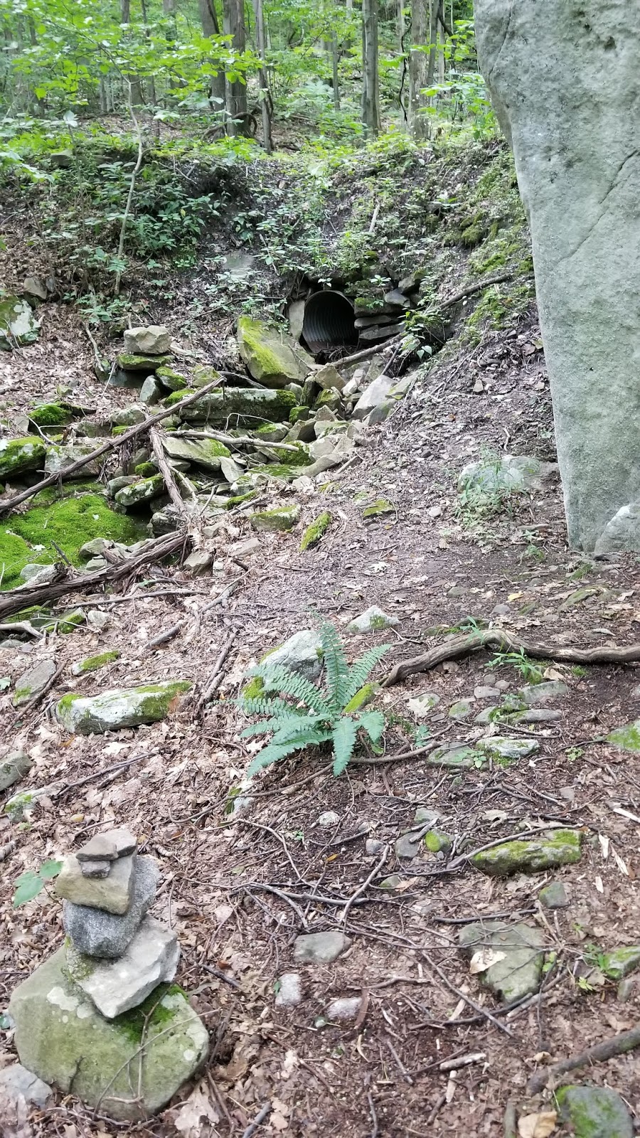
At 41°30'29.4"N 76°56'14.7"W
There was a large boulder, beside a drain pipe, with an inuksuk at the top. We decided to leave the road and follow this "path" downhill. That took us past this Wanna Be Waterfall.

Unknown Waterfall Wannabe?
41°30'26.3"N 76°56'11.8"W
It hadn't rained in a few days, it's possible this is fuller in spring, or after a good rain.
We did this hike, saw 3 waterfalls on Rock Run, and swam at Rock Run, had a picnic here, and were home in time for supper. It was an absolutely beautiful day!
---------------------------

Looking for more waterfalls? I have a list by county, and a map of them, here:
No comments:
Post a Comment
I'll read the comments and approve them to post as soon as I can! Thanks for stopping by!