
- Our Road Trip Audio Book - No Barriers by Eric Weihenmayer
- Breakfast At Gram's In Lewisburg
- Quick Stop At Oma's Antique Emporium for German coffee
- Hiking & Geocaching at R.B. Winter State Park (Half Way Dam)
- Geocaching In Loganton Area (seeing a covered bridge, a spring, and more)
- Dinner at the Twilight Diner in Loganton Pa
- 11 total caches found (including 1 earth cache & 1 puzzle cache), 1 DNF (Actually we found it - but we couldn't get to it - it is completely encased in ice)
- A facebook album of all of the photos from our mini road trip


We started our morning at Gram's Place in Lewisburg for breakfast. This is one of my favorite places to eat - lunch or breakfast! Dan ordered a cannoli crepe, I had the Gram's Omelet. Both were REALLY good, as always! (For lunch, try the Korean pork tacos! )
Next was a quick stop at the Dollar Tree in Mifflinburg. It's one of the nicest Dollar Trees anywhere around us. Always clean, great staff, and a great selection! Dan found a few new things o make into geocaching containers, and I found a few more things to add vinyl to, with my cricut.

Oma's Antique Emporium
Located ride beside the fire station on the main street
Then we headed to Oma's Antique Emporium in Mifflinburg. Our daughter is currently living in Germany, and Oma's was offering free samples of German coffee for their grand opening week-end
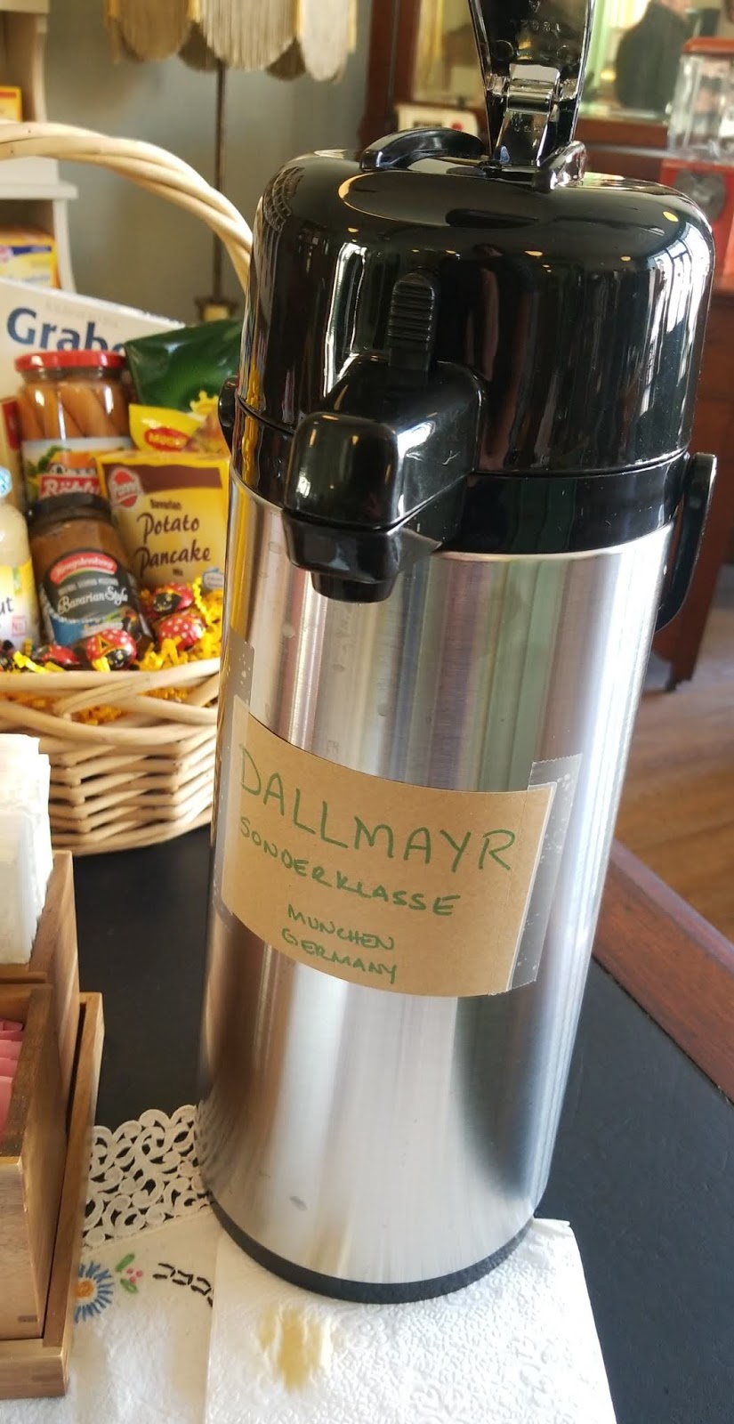

I couldn't resist. The coffee was really good! And the Antique Emporium is beautiful. It's an old hardware store, be sure to check out the old photos on the back wall. They have an amazing original advertising sign, that they found in the original wooden packing crate in the top of the carriage house out back. There's a wall of German foods, and a wonderful collection of antiques and collectibles, AND they sell coffee, and have tables to sit at. For us Gilmore Girls fans, it's not exactly Luke's, but it's a former hardware store that now sells coffee... The owner are wonderful too. I can't wait to try the recipe they shared.
Open week-ends only, 10-4.

This is one of the neat things I saw here - 1940's Muggsy pfaltzcraft! I had no idea this pattern exists. I love it! It's definitely not what I think of when I think Pfaltzcraft!
We've already found all of the geocaches in Lewisburg and Mifflinburg, so there were no caching stops for us through here. There are lots of caches in both of these towns!

From there we headed to R.B Winter State Park, where it was not only much icier than we expected, but also much more crowded! While crowded might be a stretch, compared to summer crowds, there was never a trail or section where we did not see people, and the dam parking area was completely full. It was really a beautiful winter day for hiking, and we were not the only ones to appreciate that. :-)

Our first cache was a multi stage earth cache. It took us to several spots we were already familiar with - and they are some of our favorite spots! We explored fisherman's cave, measured worm burrows in the sandstone in the pavilion, compared the temperature of the "small bubbler" spring (where we used to keep watermelons cold for summer picnics) to the temperature of the lake (which today was frozen pretty solid). It also took us up to the overlook, which was right beside the parking area for the first hike.


This hike was about half a mile one way on the Overlook trail. It was mostly flat, completely snowy and icy, and absolutely beautiful! We walked out to the power lines and enjoyed the view across to the opposite mountain. On our way back, we met another hiker and his two beautiful dogs.

Next were two "quicker" caches - one at the visitors center (which took us way too long to spot - we were not following the coords well enough!) and the other was another short, icy, hike, to a letterbox cache completely submerged in ice. There was no way for us to dig it out - we even tried using a large rock to break the ice.. it's just too solid and too thick. Then we read the logs, and if we had done that sooner, we would have known this! We passed another family on this trail, and another couple near the visitors center when we returned.

From there we headed to our longest hike of the day. It was meant to be a bit shorter, but Sandy Hill road was closed, so we had to approach from the other direction, making it about a mile one way. One mile is nothing! But it's 500 feet straight up, on a trail of ice. There was a large group hiking it ahead of us, but they were so much faster than us that they were out of our view in no time at all.

This was one of those hikes where you think you can see the top, and then the trail turns a bit, and you go up some more. That happens about 4 times. Then you are on a flat section, and your legs start to loosen back up and you think that wasn't so bad! I did it! And then you start going up hill some more. And some more. And some more. It was truly beautiful, and now that it's over, I am so glad we did it!
Actually, to be fair, when we got to the geocache at the rocks I really loved that I had done it.

But then we had to go back down. Want to know what is worse than a trail that goes straight uphill? A trail of ice steeply back down the hill.
I should probably mention that not only am I overweight, and out of shape, I have a particularly bad case of plantar fascitis right now. If you are not familiar with plantar fascitis, it's an inflammation of a band of tissue in your foot, in my case caused my being overweight and never wearing appropriate footwear. Every time my heal strikes the ground it feels like I stepped on a railroad spike at an angle - sending shooting pain from my heel across my foot. It comes and goes for me, but after a week of hiking and walking in my farm boots, it's particularly bad. Treatment involves exercises (which I do) Advil to help with the swelling (I forgot to take it) proper footwear, and rest.

So I wore slightly less inappropriate footwear, and hiked a few miles up and down icy trails all day. That's close to the prescribed treatment, right?
I had found a perfect walking stick when we were near the pavilion early on in our day, it was a life saver all day - especially coming down that icy hill!
Side note - I came home tonight, sat down for a few minutes, and then when I went to stand back up, decided I most definitely needed an indoor walking stick. I happened to have one in the hall closet, from after my knee surgery. Technically I believe most people call this a "cane", but I'm sticking with "indoor walking stick".

Purchased at Oma's - these are big. The marshmallow is softer than what we are used to in the marshmallow bunnies, and they have a wafer at the bottom. Very good!
About half way down the mountain, when I was vacillating between sitting down and sliding down the hill on my butt, or taking off my shoe and icing my foot in the snow (both very bad ideas) I suddenly remembered that I had purchased chocolate covered marshmallows at Oma's. And I had a renewed desire to make it down the hill alive and without hypothermia.
It really wasn't THAT bad of a hike. Now that it's over I love it. While I was actually doing it... there were some minutes where I was wondering what on earth made me think this would be fun. And it was incredibly humbling to realize how much I struggled with this short little hike up the mountain, while listening to an audiobook about a blind man who climbed Mount Everest and kayaked the grand canyon, all while adopting and raising a troubled little boy from Nepal. (That doesn't even begin to touch on this book which could be 12 books - there are so many incredible stories, and incredible people in this book!)
So we made it down the mountain, the access road perhaps being the most treacherous part, as it was also a downhill sheet of ice... then decided that that wasn't enough adventure for one day. We were feeling especially victorious from that beautiful hike, now that it was over, and decided to head on over to Loganton to tackle a few more caches.

Our first three caches were simple cemetery caches. Then a guardrail cache. (NOT my favorite thing, but it was necessary for the puzzle cache answers). Then we got to see a beautiful old church bell, in the busiest church cemetery I have seen. Kids were riding their bikes down the grass hill in front of the church, kids were playing beside the church, kids were playing behind the cemetery... Don't get me wrong, I LOVE seeing kids playing outside. This makes me happy. But you never expect to see that many kids around a cemetery! We were able to locate the cache without them paying any attention to what we were doing.

"Logan Mills is the site of the only remaining covered bridge in Clinton County. The 45-foot bridge was constructed in 1874. It was placed on the National Register of Historic Places in September 1979"
Next up we found a cache at a covered bridge! I love covered bridges. This one almost got Molly and I killed though. I think the people who live on the other side of the bridge are a bit too comfortable with the road leading to their house - he never stopped at the stop sign. Thankfully I heard him coming, immediately understood he was traveling fast and would probably not stop. I grabbed Molly, and hobbled to the end of the bridge as fast as possible. He saw me and slowed down, but it was a little scary! There are signs posted inside the bridge to read - it's obviously meant for pedestrian traffic, we were not in the wrong this time. He was going WAY to fast, and never stopped at the stop sign before the bridge . Had he stopped, he would not have been coming nearly as fast across the bridge.
You can see the mill off to the right behind the bridge-
"Logan Mills is also the site of a stone gristmill built in 1840 by Colonel Anthony Kleckner. When Colonel Kleckner died in 1860, it was purchased by the Ilgen family and was in operation until the mid-1950s. New owners, Glenn Vernon and Claudia Albertin, have purchased and the mill and some surrounding buildings and are refurbishing them for historical purposes."

On our way out, I asked Dan to stop at a cemetery we passed, I had spotted this tombstone from the road and loved the uniqueness of it. The craftsmanship that can be found in many old cemeteries blows me away.

While the history sites state that the indians believed the water had "medicinal purposes", the geocache description elaborates -
"This cache is located in Loganton around the "S" turns. It's where Chief Logan found a water supply in which he believed healed a hangover. Bring a cup and try the water."
Then our next cache was at a spring - called sulpher spring. The description told us to bring a cup, and we did... but it was a bit off putting to see all of the garbage in the spring. Still, the area where the water comes out was clean enough, so we tried it. Sulpher spring is an accurate name. :-)

Our last stop was for supper at the Twilight Diner. We've seen the signs for this on the highway many times, and have wanted to check it out. When we pulled up, Dan asked if was sure. There was an abandoned looking RV, a variety of beer signs, and it looked a bit like a run down bar from the outside. We walked inside, to see tables of senior citizens, and eclectic mix of retro diner and country decor, with mason jars of moonshine for sale on the counter. It was very much a family place, with great diner food! I couldn't talk Dan into trying the jiffy burger though... (peanut butter and pickles on a hamburger)

We ended up with the mountain sandwich, and a gryro. The fries were seasoned and really good! I would definitely stop again if in the area.
We left the house at about 9am, and were home before 7 pm. We saw dozens of great things, had two great meals, hiked about 6 miles total, and found 11 geocaches, including a puzzle cache and an earth cache. And I got a new German recipe that I cannot wait to try.
It was a great day - this is a trip I would recommend!!
Read more about The Sugar Valley Area

Our favorite restaurants, and a list of others we want to try:
No comments:
Post a Comment
I'll read the comments and approve them to post as soon as I can! Thanks for stopping by!