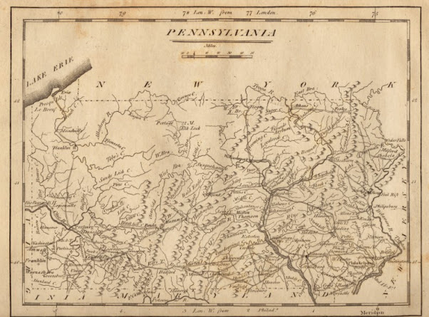
A Pictorial Relief Map Of Pennsylvania, 1806
Created & Published by Matthew Carey
Engraved by William Barker
From Carey's Minor Atlas, 1806
Relief Map Shown Pictorially
Engraved by William Barker
From Carey's Minor Atlas, 1806
Relief Map Shown Pictorially
A Closer Look at Our Susquehanna Valley, as shown on this map:
Zoomed in even more:
Find The Full Map Online Here:
==============
Find An In Progress Index Of Where To Find Local Maps Here:


No comments:
Post a Comment
I'll read the comments and approve them to post as soon as I can! Thanks for stopping by!